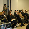
SCEC Phase III Press Conference is a "Hot Spot" for the News Media
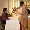
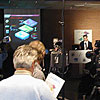
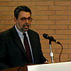
Bob de Groot distributes press kits
and friendly greetings. |
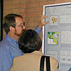
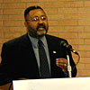
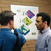
Chris Wills explains a Phase
III poster. |
Text and photos by John Marquis
The announcement of research that located
"hotspots" of ground-motion amplification in the Los
Angeles area turned the Davidson Executive Conference Center
at USC into a kind of "media hotspot" on Tuesday, January
16, as reporters from over 30 different news organizations converged
to hear what SCEC scientists had to say. The press conference
was organized by Mark Benthien (SCEC) and Bob Calverley (USC
News Service) with the help of many others.
[For an overview of the Phase III report
and technical resources, visit the SCEC
Phase III web page.]
The press conference, which represented the official release
of the results of years of research conducted by the SCEC Phase III
working group, was set to begin at 10 a.m. in the conference
center's Figueroa Room. As the hour approached, members of the
press arrived and were welcomed by Bob de Groot
(SCEC), who handed out press kits full of relevant information,
including the joint USGS/SCEC
fact sheet. Crews from television stations (there were 13
represented!) were also given a video tape of "B-roll footage"
-- broadcast-quality versions of the images and animations used
in the presentation. Those who arrived early had a chance not
only to claim seats and the prime spots for their cameras, but
also to conduct brief interviews with some of the scientists
involved. Some were able to get first-hand explanations of background
material that was central to the research announcement. By the
time the conference began, representatives from a diverse cross-section
of southern California's television, radio, and print media --
a total of 30 different organizations -- filled the conference
room.

A phalanx of cameras spanned the
width of the Figueroa Room. |
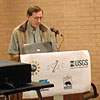
Tom Henyey delivers his opening
remarks at the Phase III press conference. |
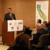
With a phalanx of cameras set in place
across the width of the room, Dr. Tom Henyey, SCEC's Executive
Director, delivered opening remarks. Explaining that SCEC is
a National Science
Foundation (NSF) Science and Technology Center that receives
its funding from both the NSF and the U.S. Geological Survey (USGS), Henyey reviewed
the Center's goals and its current status as a means of setting
the background for the presentation of the Phase III results. He pointed
out that SCEC, entering its eleventh -- and potentially final
-- year of funding, has actively worked not only on sponsoring
the research of earth scientists, but on "integrating or
pulling together results from a variety of different studies
of earthquakes to improve our seismic hazard models." This
integration of research, Henyey said, has led to the publication
of three major reports over the last ten years."
Henyey explained that "the first report investigated
the implications of the 1992 Landers earthquake on the future
seismicity of southern California, and in particular, its effect
on the nearby San Andreas fault." (As an indication of the
Center's commitment, this study was labelled the "Phase
I" report.) One of the results of the second report (known as "Phase
II"), "a comprehensive study of earthquake probabilities
over the next 30 years for southern California," said Henyey,
was "a map of southern California depicting those areas
where earthquake shaking is expected to be more frequent or intense"
relative to other areas. This map of seismic hazard has been
distributed to the public throughout southern California as part
of the booklet Putting Down Roots in Earthquake Country.
The third report ("Phase
III") -- the "most ambitious, to date,"
according to Henyey -- was produced by SCEC in collaboration
with the USGS,
the California
Division of Mines and Geology (CDMG), and the California Department of Transportation (Caltrans),
and relied on the contributions of "more than 20 researchers."
The Phase
III report, Henyey said, "deals with the fundamental
questions of whether site effects can be accounted for in seismic
hazard analysis." Though the results presented at this press
conference represent "a partial answer to these questions,"
Henyey cautioned, "there is still much more work to be done."
And with that, he turned over the podium to Ned Field, a scientist from the Pasadena office of the USGS, and the lead
author of the SCEC
Phase III report.
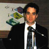
Ned Field of the USGS summarizes
the science and results of the Phase III report. |
The audience follows along with
Ned Field's PowerPoint presentation. |
Upon taking the podium, Dr. Ned Field thanked
everyone present for their attendance and acknowledged the contributions
of the 20 other scientists in the SCEC Phase
III Working Group. To understand how those scientists
came to identify "hotspots" of shaking amplification
in the Los Angeles region, Field said, it is important to understand
the basics of seismic hazard assessment. With that, he began
a PowerPoint presentation explaining the background and
summarizing the results of the study conducted by the Phase III
Working Group.
Field noted that while there are two parts to seismic hazard
analysis -- earthquake forecasting and ground shaking estimation
-- Phase
III was concerned only with the latter. Showing two animations
of the shaking from a simulated earthquake, he demonstrated how
shaking can be dramatically affected by variations in the composition
and structure of the rocks beneath us. This is, by no means,
an entirely new idea, he said; John Milne, a pioneer in the field
of seismology, had noticed 100 years ago that the shaking at
two sites only 1000 feet apart could differ in intensity by a
factor of 10! Far more recently, the Northridge earthquake sparked
a renewed interest in this phenomenon by generating small pockets
of intense shaking in unexpected areas.
Field pointed out that when discussing shaking, the emphasis
is not so much on ground motion, as it is on the response of
buildings to that motion. Ignoring variations in geology (as
was the case in the first of the two animations he showed), Field
said, there are two factors that influence the amount of shaking
from an earthquake that a given location will experience: the
magnitude of the earthquake and the distance from the earthquake's
source. He demonstrated these with a pair of plots using data
from past events in southern California. Magnitude alone can
generate variations of about a factor of 10, over the range of
damaging magnitudes (M 5 to M 7.5)
expected in southern California. The difference in shaking between
a location right above the source and one 100 kilometers away
is typically about a factor of 20.
But local geology can also affect the amount of shaking at
a site, Field said. Prior to the Northridge earthquake, the distinction
made for changes in geology was simply "soil vs. rock,"
with soil expected to shake about 1.5 times more than rock. According
to Field, one fundamental question the Phase
III Working Group wanted to answer was, "Can
we do better than rock vs. soil?" With the help of a map created by Chris
Wills and others from the California Division of Mines and Geology (CDMG),
the answer is yes, he said. This map shows the "softness"
-- the speed of shear waves in the upper 100 feet of the Earth's
crust -- of rocks all across California. From this, the working
group was able to determine that the difference in shaking would
be about 2.5 times more for the "softest" sites than
for the "hardest."
Since the Northridge earthquake, the effect that basins can
have on local shaking has also been under intense study. In particular,
the depth of the sediments beneath a site can influence the amount
of shaking at that site. Field showed the results of the working
group's investigations into basin depth as an animated 3D
map of the Los Angeles area. Comparing the effects of a basin
to a bowl of gelatin, he said that this data provided a "good
view of the shape of this bowl for the Los Angeles Basin,"
and that the difference in shaking between the edge and the center
of such a basin will be about a factor of two.
Taken together, Field said, these findings constitute "a
substantial improvement in our ability to predict areas where
the shaking will be more than in other areas." His point
was illustrated by a slide showing the new Phase III
shaking amplification
map next to a map that might have been prepared for similar
purposes prior to the Phase
III study. The difference in the figures was clear
-- the old map showed only the difference between hard rock and
soft soil in southern California, while the new map showed distinct
"hotspots" in some of the local basins where shaking,
on average, could be expected to be many times greater than in
more stable areas. But the working group, he claimed, also came
to another very important conclusion: "in addition to the
average behavior shown in our new map, each earthquake will also
have its own unique pattern of hotspots." He showed the
audience maps
of the resulting hotspots from four different earthquake simulations,
and said that "these types of simulations constitute our
only realistic hope of making more accurate shaking predictions
in the future; making them reliable enough for general engineering
use will require a concerted effort even larger than that reflected
in the SCEC working group study we're discussing today."
To conclude, Dr. Field outlined four steps for following up
on the research conducted by the SCEC Phase
III Working Group. The first step is the dissemination
of this research, published in the form of 14 technical papers
that make up a special issue of the Bulletin of the Seismological Society of America
(BSSA). Second, Field said that "earthquake engineers,
insurance companies and emergency management officials will evaluate
the implications of [these] findings and modify their strategies
accordingly." Third, Field called on his fellow scientists
to "proceed with the challenging task of devising more reliable
case-by-case scenario earthquake simulations." And finally,
echoing the beginning of his talk, he expressed the need to "return
to the other half of seismic hazard analysis" -- the attempt
to forecast where and how often large earthquakes are likely
to occur in southern California.
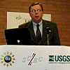
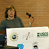
Dr. James Whitcomb (NSF) addresses
SCEC's progress as part of the STC Program. |
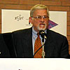
Dr. Patrick Muffler (USGS) expresses
his support for the Phase III project. |
Following Ned Field was Dr. James Whitcomb,
acting Deputy Division Director for the Division of Earth Sciences of the National Science Foundation (NSF). Dr. Whitcomb
said he was "very pleased to be here on this occasion,"
and called the study "a very important milestone in the
life of the Southern California Earthquake Center." SCEC
was founded as part of the NSF's Science and Technology Center (STC) Program
more than 10 years ago. An essential goal of the STC program,
Whitcomb noted, was to create centers in such a way that each
turned out to be "greater than the sum of its parts."
Said Whitcomb, "this is indeed the case at the Southern
California Earthquake Center, in that they have led the way in
integrating several different scientific disciplines, integrating
earthquake engineers, and integrating partnerships with agencies
-- federal, state and local -- to address the problem of seismic
hazard, [thereby] reducing the loss of property and life from
earthquakes." Dr. Whitcomb closed his remarks by congratulating
the center on its progress.
Tom Henyey then introduced Dr. Patrick Muffler, the western
regional geologist for the USGS
based in Menlo
Park, California. Dr. Muffler said he was "pleased to
be [there] representing Chip Groat, director of the [United States]
Geological Survey in Reston, Virginia." From the USGS point
of view, he said he wanted to emphasize how "scientifically
fruitful" the partnership with SCEC has been, and that the
USGS looks forward to more collaboration with SCEC in the future.
He called the results of the Phase III report "exciting,
good stuff" that should complement the Advanced National Seismic System under development
by the USGS. Thanking the group for giving him the opportunity
to speak at the press conference, Dr. Muffler said he anticipates
seeing many more refinements to this kind of study, and in general,
"more interesting [results] coming out of SCEC in the next
few years."
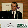
Jim Davis (CDMG) discusses his department's
involvement in the Phase III project. |
Ed Bortugno (OES) speculates on
the possible application of Phase III results. |
The next official introduced by Tom Henyey
was Dr. James Davis, the state geologist for the California Department
of Conservation's Division of Mines and Geology (CDMG). On behalf
of all the CDMG staff, Davis said it "has been our pleasure"
to have worked with SCEC "since its inception over 10 years
ago." He said he wanted to "observe the contributions
that the state has made scientifically to [the Phase
III] effort" and also "consider... some
of the public policy applications the state is responsible for
applying in its effort to protect the safety and reduce the damage
its citizens are subjected to."
Speaking of the Phase
III report, Davis called it "a continuum point
in the development of an increasingly rigorous understanding
of the earthquake shaking potential in southern California."
Indicating the CDMG map
of rock "softness" data, referred to by Ned Field in
his presentation, Davis said the CDMG was "delighted at
the application of this data in Phase III." Noting that
another of the state's contributions to the study was a set of
data from the strong motion instrumentation program, Davis added
that "the governor's office has chosen to put" a total
of $6.8 million in funding toward "a statewide seismic mointoring
network,... an expansion of TriNet,
in the governor's budget for the coming year." This funding,
he said, "will enhance and increase the activity of monitoring
earthquakes in southern California" and expand "greatly
the monitoring of earthquakes in northern California," both
of which "are important to estimating the loss that is to
be expected from future earthquakes."
Next up at the podium was Ed Bortugno, senior geologist for
the California Governor's Office
of Emergency Services (OES), representing the director of
the OES, Dallas Jones. He thanked SCEC, the USGS and the CDMG
for inviting the OES to comment on what he called "this
new important research." According to Bortugno, one of the
"prime responsibilities" of the OES "is to provide
good loss information" after any kind of destructive event.
This information can be used to ask for federal funds if the
event becomes a "presidentially declared disaster."
As an example of the importance of making accurate loss estimates,
he explained that, within about 24 hours after the Northridge
earthquake, the computer model used then by the OES "estimated
about $13 to 15 billion in damage," while the actual damage
figures "are probably closer to about $40 billion."
"So," Bortugno said, "information such as [the
Phase III
report] is going to only help us improve these estimates."
Bortugno said that "another use of loss modeling"
is the "prioritization of mitigation in California."
He pointed out that while we have good building codes now, we
have "a large number of old buildings that were built prior
to these... building codes," and so "we need to begin
the process of retrofitting these structures to make them safer."
Information like that in the Phase III report, Bortugno claimed, "is going to help
us prioritize those areas where we need to do it first."
Ellis Stanley (City of LA) address
the importance of Phase III to emergency preparedness
personnel. |
Lucy Jones (USGS) addresses the
audience and fields questions. |
The next official to speak was Ellis Stanley,
general manager of the Emergency Preparedness Department for the
City of Los
Angeles. From his point of view, the most important thing
about the announcement of the new Phase
III results is likely to be their impact on the process
of planning and development that goes on in the city of Los Angeles.
He remarked that 25 years ago, when he started working in the
field of emergency preparedness, or even "as recently as
Northridge," no one had this kind of information to take
before the city council and argue persuasively for the implementation
of stronger safety standards or a prioritization of areas with
buildings in need of seismic retrofit. Mr. Stanley also suggested
that the work behind today's announcement could add realism to
future emergency preparedness drills, like the "full-scale
unannounced test" of response in the wake of a simulated
magnitude 6.8 earthquake on the Palos Verdes fault zone to occur sometime
in the near future. Finally, he added that he hoped that this
report and the efforts of SCEC partnerships would better "help
citizens understand their potential hazard."
Finally, Tom Henyey introduced Dr. Lucy Jones, who he called
southern California's "earthquake mom" (she is locally
famous for appearing with her sons on post-earthquake TV coverage)
and who is now scientist-in-charge of the earthquake hazards program of southern California
at the office of the USGS in Pasadena. She prefaced her remarks
by stating that she was speaking that day in three different
capacities: as a scientist of SCEC, as a federal official trying
to reduce the earthquake hazard in southern California, and as
a citizen of southern California.
Addressing the significance of the Phase
III findings, Jones made reference to a common saying
of hers: "Earthquakes don't kill people, buildings do."
This is a clever way of saying that if we want to prevent loss
of life in a future earthquake, we don't so much need a better
understanding of the earthquake itself, but rather, we need a
"better picture of what the earthquake will do to buildings,"
according to Jones. One of the primary applications of this research,
she said, echoing Ed Bortugno, should be as a tool to prioritize
retrofitting of older buildings. She also noted that the study's
results could have the more subtle application of allowing better
data interpolation between the TriNet
stations used to generate ShakeMap, the graphical view of ground motion
created in the wake of signficant earthquakes.
As for inappropriate uses of the Phase
III findings, Jones said that this report is "not
something someone will go look at to help decide where to buy
a house." Saying that this should be just another tool to
help average citizens manage their risk, she pointed out that
if you were to move away from the shaking amplification of the
basins, you would be moving "toward the brush fires."
That produced a chuckle from the audience, but her point was
made. She wrapped up by explaining why she sees SCEC as a valuable
resource to research in southern California. She said SCEC's
greatest sucesses have been the creation of a "consensus
voice" among scientists from different institutions and
the bringing together of the "best minds..., turning [research]
into practical products."
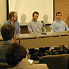
Ned Field responds to a question
asked of the panel. |
The crowd listens attentively to
the panel. |
Ed Bortugno responds to a question
from the audience at the end of the panel session. |
At the end of her speech, Lucy Jones introduced
the four scientists on the "panel of experts" that
would respond to questions from the floor. On the panel were
Ned Field of the USGS, Harold Magistrale from the University
of California at San Diego, Kim Olsen from the University of
California at Santa Barbara, and Chris Wills from the CDMG. The
officials also remained at the front of the room, to step up
to the podium and help address questions if necessary.
One of the first and most poignant questions came in response
to a comment from Ned Field about each earthquake having its
own unique "hotspots." If that's the case, it was asked,
then what good is this study? Field countered that since it's
impossible to know where the next big earthquake will be, the
average behavior is more useful to know -- "we don't want
to get too hung up on the details," he said.
It was brought up that the publication of the map of hotspots
might cause some concern among those people who live near the
center of those hotspots, such as the one near the intersection
of the 105 and 710 freeways. "What do you say to those folks?"
asked one reporter. To answer that, Ned Field echoed Lucy Jones'
warning from earlier in the conference, saying that this study
should not be considered the end-all, and that there are other
things to think about when computing your risk. "I don't
think... someone should consider moving on the basis of this
amplification," Field added.
The recent destructive earthquake in El Salvador was brought
up several times during the question-and-answer session. Responding
to a question about turning this research into policy, Ellis
Stanley said that "in my business, we have small windows
of opportunity; I dare say that had we not had our little shake
Saturday" (referring to a magnitude 4 earthquake near Sylmar)
"or did not have El Salvador, half of you wouldn't be here
-- maybe two-thirds of you wouldn't be here." And in another
question, the panel was asked how this kind of study might help
"third-world countries like El Salvador," and how such
a country could "find the money to do this." Ned Field
responded that while it was true that small countries might not
be able to conduct such a study independently, the SCEC Phase III
Working Group has already found a lot of the "pitfalls,"
thus "saving other countries from going through that learning
process" so that they can streamline their efforts.
Harold Magistrale and Ned Field
are interviewed after the conference. |
Lucy Jones is interviewed by several
local television stations. |
Kim Olsen explains Phase III
results to a reporter. |
SCEC's Tom Jordan is interviewed
at the end of the press conference. |
Mark Benthien, Tom Jordan, and John
McRaney (SCEC) talk with Peggy Brutsche (Red Cross) and Jack
Popejoy (KFWB). |
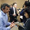
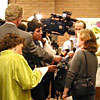
After the panel session was over, media
representatives were given the chance to conduct individual interviews
with the scientists and officials involved in the Phase
III project. Some of these were quite formal, with
cameras rolling, while other interviews more closely resembled
private, informal conversations. Tom Henyey talked about the
Center's work, Harold Magistrale discussed the subsurface geology
of the Los Angeles area, and Kim Olsen explained the simulations
of scenario earthquakes. Ned Field and Lucy Jones were both popular
targets for the television cameras. SCEC's future Director, Tom
Jordan, was also present to answer questions.
The scientists and staff of the Southern California Earthquake
Center would like to thank everyone involved in the January 16th
press conference for contributing to this important milestone
in SCEC's history.
[For an overview of the
Phase III report and technical resources, visit the SCEC
Phase III web page.]
Cooperating Organizations
|


